LiDAR · Mapping · Analytics
Accurate & Affordable 3D Reality Capture
Accurate & Affordable 3D Reality Capture
for Infrastructure at Scale
End-to-end LiDAR mapping and analytics that turn field scans into engineering-grade, colorized, georeferenced point clouds — with continuous, maintenance-friendly insights.
PRODUCT & SOLUTIONS
From Data Acquisition to Actionable Intelligence.
PhiSCAN
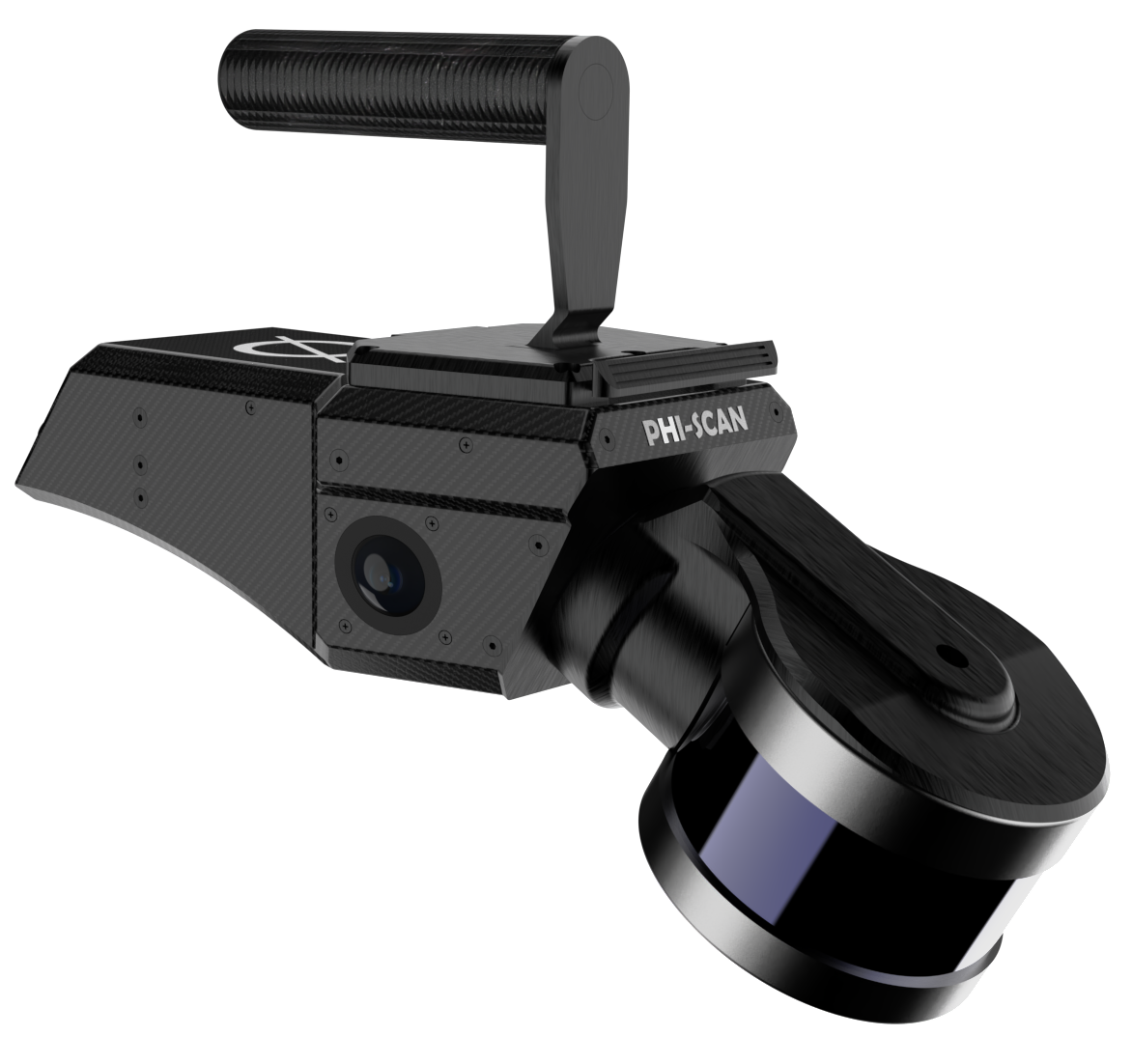
360° Rotating LiDAR System A compact, rugged
scanning unit that captures a full 360°
field of view and fuses it with imagery to
produce accurate, engineering-grade,
colorized, georeferenced point clouds in a
single pass. Designed for rapid deployment
on tripods or vehicles, it streamlines
survey workflows, reduces re-visits, and
exports in standard formats for immediate
use in GIS/CAD and digital-twin
environments.
PhiSCAN.AI
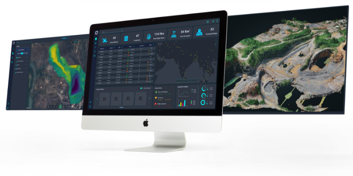
Interactive 3D Data Analytics Platform A
browser-based workspace that takes your
lidar data and transforms them into
actionable intelligence - visualizations,
measurements, comparisons over time, and
shareable reports. Track change, flag
anomalies, collaborate with your team, and
connect outputs to existing asset-management
and inspection processes to improve
planning, observation, and preventative
maintenance.
WHO WE ARE
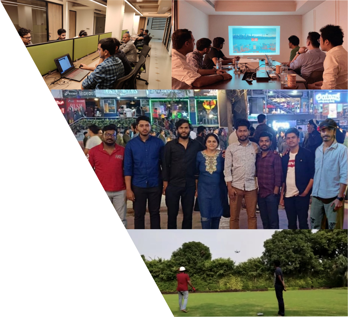
The Builders Behind the Product
Phicode was
founded by IIT Kharagpur graduates
with deep experience across robotics, GIS, and cloud
software. We work closely with
GIS, LiDAR, and drone-mapping
partners, blending field know-how with engineering
rigor to deliver reliable mapping systems and
decision-grade insights.
Be part of an ambitious, creative, and fun-loving
team.
We're looking for passionate people across
technical and non-technical roles.
Explore Open Roles →